
Published
Geomemetics is the emerging science of weaponized virality, urban firewalls and the physical footprint of the internet.
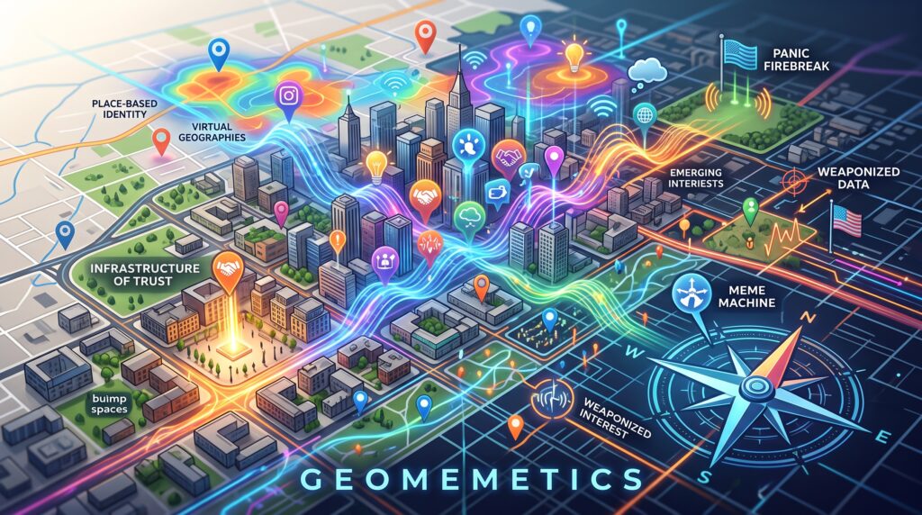
We have spent the last two decades operating under a dangerous delusion: that the digital world and the physical world are separate.
We talk about data existing in “the cloud” and treat memes as harmless, placeless pixels on a screen.
But ideas do not just live in the digital ether. They colonize physical space.
When a viral TikTok trend causes a quiet rural town to be overrun by tourists, or when a localized political conspiracy physically alters the zoning laws of a specific municipality, we are witnessing a new kind of physics. It is the physics of cultural propagation.
Enter Geomemetics, an emerging interdisciplinary science synthesizing Cultural Geography and Memetics to ask a deeply disruptive question: What is the physical footprint of an idea?
The Anatomy of a Geomeme
Geomemetics stands on two foundational pillars.
The first is Memetics, the evolutionary framework introduced by Richard Dawkins that treats ideas as self-replicating units (memes) subject to mutation, competition, and natural selection.
The second is Cultural Geography, which provides the spatial context like physical borders, urban density and infrastructure that accelerate or choke the spread of these replicators.
Historically, we assumed memes were placeless. Geomemetics argues the exact opposite: a meme’s survival depends on its “Place-Based Identity”.
An idea that thrives in the dense, transit-heavy urban fabric of Tokyo might fail completely in the suburban sprawl of Los Angeles. Ideas require a host space.
But what happens when bad actors figure out how to exploit this?
The Weaponization of Geography
Weaponizing information geographically is not a new concept, but its precision has evolved from crude analog air-drops to pinpoint digital targeting.
By exploiting the intersection of physical location and cultural vulnerabilities, state and non-state actors can engineer real-world events using purely digital tools.
During World War II, the U.S. Office of Strategic Services executed Operation Cornflakes, forging German postage stamps and dropping mailbags of anti-Nazi propaganda near bombed mail trains.
The goal was to trick local postal workers into injecting the propaganda directly into the physical logistics network of a specific geographic region.
Today, that same geographic targeting is done with terrifying digital precision:
- Geotargeted Psy-Ops: In the conflict in Ukraine, Russian forces have utilized electronic warfare systems, such as drones acting as spoofed cell towers, to send highly localized SMS messages directly to soldiers in specific trenches. These messages claim their commander has fled or their unit is surrounded, generating intense localized panic using zero kinetic force.
- Algorithmic Astroturfing: During the 2016 U.S. Election, foreign actors created localized Facebook groups posing as grassroots organizations. In one notable instance in Houston, Texas, they successfully organized two opposing protests at the exact same physical location and time. They weaponized a digital space to force a physical confrontation.
The ultimate goal of weaponized geomemetics isn’t just to change minds—it is to alter the physical world. A successful campaign translates digital anger into physical votes, migrations, riots, or paralysis within a targeted grid.
The Urban Firewall: Architecture as Defense
If our physical spaces are under digital assault, how do we defend them?
You cannot fight a geomemetic attack with just better algorithms.
The ultimate defense against a digital lie is a highly visible, easily navigable, and socially cohesive physical reality.
Urban planning and architecture are our front-line defenses against disinformation and panic.
1. The Infrastructure of Trust (Breaking Echo Chambers)
Disinformation thrives in social isolation.
If a digital campaign spreads a lie about a specific demographic, that lie succeeds only if the target audience never interacts with those people offline.
Cities can counter this by building an “infrastructure of trust.” Mixed-use zoning, public squares and wide pedestrian promenades create “bump spaces” which are areas that force serendipitous, low-stakes interactions.
It is immensely difficult to radicalize a population against a group they share a friendly, physical space with every day.
2. Spatial Legibility (Mitigating Panic)
In a crisis, whether caused by a real threat or a fabricated geomemetic attack (e.g., a geotargeted text claiming a bomb is in a transit station), panic is driven by confusion and entrapment.
Decentralized, multi-nodal street layouts ensure that if one central hub is compromised by a rumor, the crowd can calmly diffuse through alternative routes. Wide, unobstructed sightlines reduce the claustrophobia that fuels stampedes.
3. Analog Anchors (Establishing Ground Truth)
When citizens cannot trust their screens, the physical environment must provide ground truth.
Robust physical information hubs, un-hackable dynamic wayfinding signs, and designated civic “resilience hubs” (like libraries) serve as anchors of reality when digital networks are overwhelmed with noise.
Crash-Testing Reality with Digital Twins
To prepare for these modern crises, city planners are no longer relying on static blueprints.
They are turning to Digital Twins, sort of high-fidelity 3D geospatial replicas of the urban environment, powered by Artificial Intelligence.
By using Generative Agent-Based Modeling (GABM), planners can populate a digital city with thousands of autonomous AI agents.
These agents are programmed with individual goals, stress thresholds and decision-making capabilities.
Instead of treating crowds like fluid dynamics, AI allows planners to see emergent panic behaviors.
They can use natural language prompts to tell the system, “Simulate a sudden evacuation of a 50,000-capacity stadium with a fabricated active shooter rumor spreading on mobile devices”.
The simulation reveals exactly where panic will cause fatal gridlock, allowing architects to redesign the physical infrastructure before the building is even constructed.
The Future of Space and Mind
Geomemetics forces us to confront a new reality: the boundary between a digital idea and a physical location has disappeared.
As Spatial Computing and Augmented Reality become deeply integrated into our daily lives, this overlap will only intensify.
The ultimate question we face is no longer just how to moderate our digital platforms, but how we must design our cities, borders, and public spaces to cultivate the ideas we actually want to survive.
The internet is no longer just on our screens. It’s also on the streets, around us.